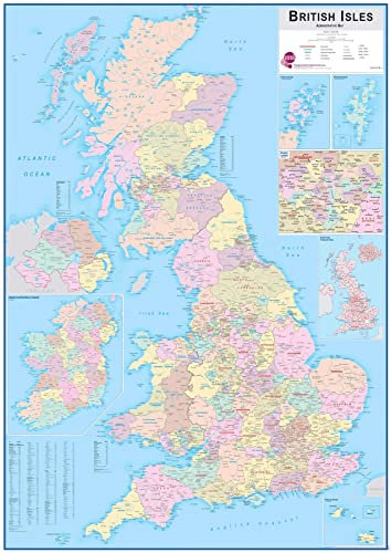
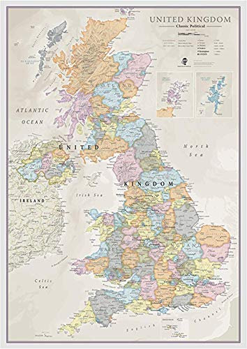
Large British Isles Administrative Map - UK Postcodes - Front Sheet Laminated - 84.1 x 118.9 cm
Show on Amazon
Show on Amazon
Offer

£ 18.99
£ 4.49 | 1-2 Days
go to shop
Price trend
Product description
- Large British Isles Administrative Map (Laminated) measuring 84.1 x 118.9 cm - Unframed
- CREASELESS DELIVERY Your Large British Isles Administrative Map is packaged by our specialist map team in Oxford, for delivery, so it arrives safely and ready to display.
- MAPS INTERNATIONAL Oxford based company with more than 50 years experience of making maps, our philosophy of 'cartographic excellence' combines detail, design and high-quality finishes in a range of stunning wall maps.
You might also be interested in these uk county map jigsaws.
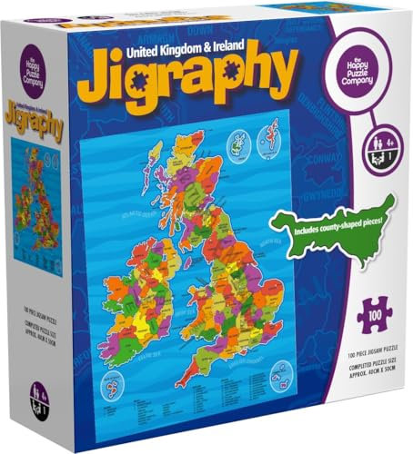
The Happy Puzzle Company Jigraphy - United Kingdom & Ireland Map 100 Pieces Jigsaw - Jigsaw Puzzle for Adults and Kids - UK & Ireland Jigsaw for Family Fun and Learning (100 pieces)
DETAILED MAP ILLUSTRATION Dive into the charm of the United Kingdom and Ireland with this 100-piece jigsaw, showcasing an intricately detailed map featuring landmarks, regions, and vibrant colors.
free shipping
Check price
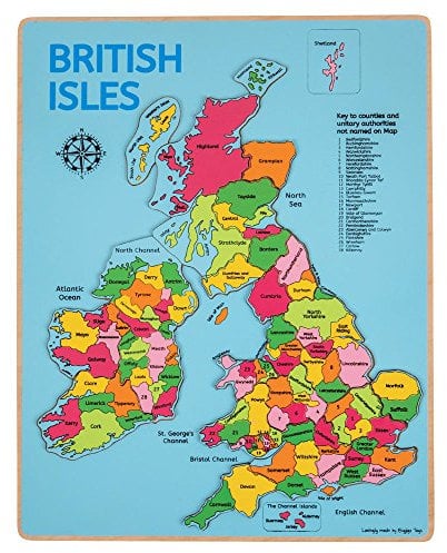
Bigjigs Toys, British Isles Wooden Jigsaw Puzzle, Map Of The UK, Geography Games, For Children
JIGSAW MAP PUZZLE - 28 piece wooden puzzle of the British Isles. Great for interactive play sessions between parents and children. Helps to improve geographical and general knowledge. 3 years +
free shipping
Check price
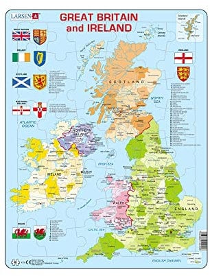
Larsen Puzzles K18 Great Britain & Ireland Political Map Jigsaw Puzzle 48 Pieces - Educational Map Puzzle for Kids & Adults - Boxless Tray & Frame Stocking Filler
MESS-FREE PUZZLING Designed with a tray and frame, this puzzle keeps pieces in place and avoids bulky boxes. Perfect for tidy storage and easy set-up, making assembly a stress-free and enjoyable experience.
Check price

Jigsaw Puzzles For Adults 1000 Piece Map Of Britain And Ireland Puzzle UK Map - British Isles Jigsaw 1000 Piece Jigsaw Puzzles For Adults And Kids - Geography Gifts by bopster
ILLUSTRATED BRITISH ISLES JIGSAW - A beautifully illustrated puzzle depicting famous and easily recognisable landmarks and geology of the British Isles.
Check price
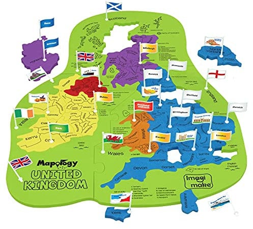
Imagimake Mapology United Kingdom Jigsaw Puzzle for Kids | Flags & Capitals, Fun Facts | Geography Educational Toys & Games | Gifts for Ages 5 6 7 8 9 10 11 12 Years | UK for Kids
THE BEST UK JIGSAW PUZZLE This United kingdom & Ireland geography map puzzle is a stem educational toy for kids age 5+ to learn while having fun with shapes and colours. Each jigsaw puzzle piece is uniquely shaped like the countries, and comes with flags and capitals. The puzzle also includes lots of fun facts about popular cities across UK to help the kids gain a deeper understanding of the geography
Check price
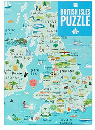
1000-piece Blue UK Map British Isles Jigsaw Puzzle with Poster - Britain Landmarks - Fun at Home Activities, Birthday Present, Travel Gifts, England, Ireland, Scotland, Wales
Test your geography knowledge with Talking Tables 1000-piece UK Map British Isles Jigsaw Puzzle and Poster. This Map of Britain features landmarks from England, Ireland, Scotland and Wales. Our Jigsaw Puzzles For Adults make for fun indoor activities
Check price

Bigjigs Toys Europe World Map Puzzle | Wooden Jigsaw for Kids | 25 Piece Set | Educational Montessori Games for Children to Learn About Countries | Geography Gifts for 3+ Year Old Toddlers
EUROPE WORLD MAP PUZZLE Name all the countries in Europe with this bright jigsaw puzzle; this puzzle board comes with 25 pieces & is great for interactive play & learning about different places around the globe; suitable for boys & girls age 3+
Check price
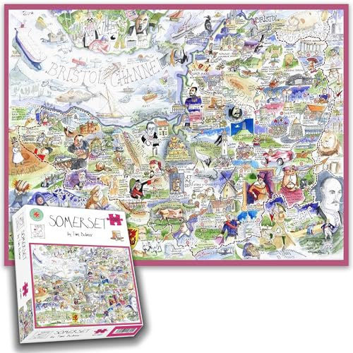
1000 Piece Jigsaw Puzzle - Tim Bulmer's Somerset Map – Hilarious and Detailed Map Featuring Somerset Landmarks, Traits, and Quirks
Detailed & Humorous Design A fantastically funny and quirky map of Somerset, highlighting iconic landmarks, local traits, and unique quirks.
free shipping
Check price
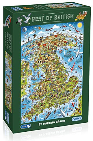
Gibsons Best of British 1000 Piece Jigsaw Puzzle for Adults and Teens Fun Map Puzzle Sustainable Eco-Friendly Made from Thick 100% Recycled Board Premium Quality Gift
ICONIC BRITAIN Explore a richly detailed map showcasing Britain s quirky and wonderful icons. Features fun illustrations of the UK s legendary landmarks, traditions, and customs - perfect for puzzle lovers and British culture fans.
free shipping
Check price

Gibsons Best of British 500 Piece Jigsaw Puzzle – Illustrated UK Map by Hartwig Braun – Colourful Landmarks & Icons Puzzle for Adults & Teens – Premium Recycled Board – Sustainable Gift Made in the UK
CELEBRATE THE BEST OF BRITAIN Explore the landmarks, icons, and quirks that make Britain unique in this colourful 500-piece map puzzle by artist Hartwig Braun. From the London Eye and Stonehenge to Highland cows and Shakespeare, it s a joyful journey across the UK.
free shipping
Check price

Close Up United Kingdom UK Puzzle 1000 pieces - Great Britain, England- 97 x 69 cm Premium Map 2021 - MAPS IN MINUTES
Made in the EU, shortened transport routes, special puzzle board.
Check price

Gibsons Wonderful World 1000 Piece Jigsaw Puzzle for Adults – Illustrated Map of Planet Earth by Maria Rabinky – Colourful World Landmarks Design – Premium Sustainable Puzzle Made in the UK/EU
ENJOYMENT AND BENEFITS A colourful 1000-piece challenge for travel lovers, geography enthusiasts, and curious minds. Encourages mindfulness and exploration while offering hours of creative fun. Includes a handy poster for easy reference.
free shipping
Check price
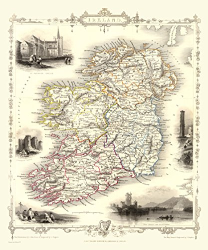
History Portal 1000 Piece Jigsaw Puzzle Map of Ireland 1851 by John Tallis
Made in UK
Check price
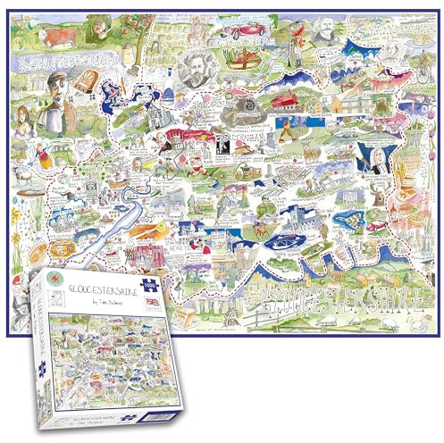
Comical Map Of Gloucestershire, Artwork By Tim Bulmer - 1000 Piece Puzzle For Adults, Large Puzzle 66cm X 50cm In Size. Challenging To Complete But Fun And Humorous
The perfect gift for family and friends, they will love this quirky jigsaw puzzle. It's comical, light-hearted and great fun to complete
free shipping
Check price

Map of London | 1000 Piece Jigsaw Puzzle | London Landmarks Puzzle | Sustainable Jigsaw Puzzle for Adults | Premium 100% Recycled Board | Great Gift for Adults | Gibsons Games
CITY OF LONDON Discover England s beautiful capital in this stunning puzzle design, featuring intricately patterned and delicately coloured artwork form Josie Shenoy.
free shipping
Check price
JYTD 1000 Pieces Adult Wooden Jigsaw-Gift-DIY Decorative Jigsaw Gift Puzzle Game Casual Toy-Map Of The UK 75 * 50CM
Our collection includes original artwork and unique prints that, once completed, are works of art perfect for an exhibition in your home. A perfect gift for any puzzle.
Check price
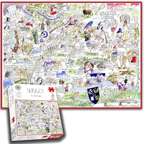
Comical Map Of Surrey By Tim Bulmer - 1000 Piece Puzzle For Adults, Large Puzzle 66cm X 50cm In Size. Challenging To Complete But Fun And Humorous
The perfect gift for family and friends, they will love this quirky jigsaw puzzle. It's comical, light-hearted and great fun to complete
free shipping
Check price
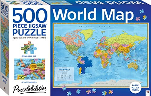
Hinkler - Puzzlebilities World Map 500-Piece Jigsaw Puzzle - Educational Home Learning Puzzle - Kids Toys - Gifts for 6 Year Olds - STEM Toys for Kids
This beautiful, detailed puzzle is perfect for anyone who likes to test their puzzle skills and expand their mind. Complete the puzzle on your own or get together with family and friends for hours of enjoyment!
Check price
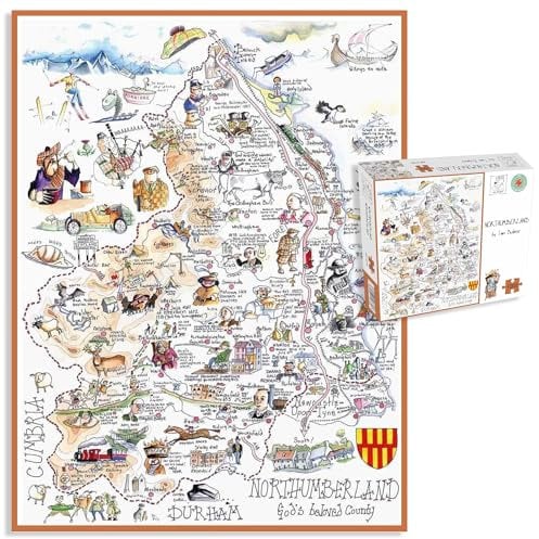
Comical Map Of Northumberland, Artwork By Tim Bulmer - 1000 Piece Puzzle For Adults, Large Puzzle 66cm X 50cm In Size. Challenging To Complete But Fun And Humorous. Makes A Great Gift For Birthdays
The perfect gift for family and friends, they will love this quirky jigsaw puzzle. It's comical, light-hearted and great fun to complete
free shipping
Check price
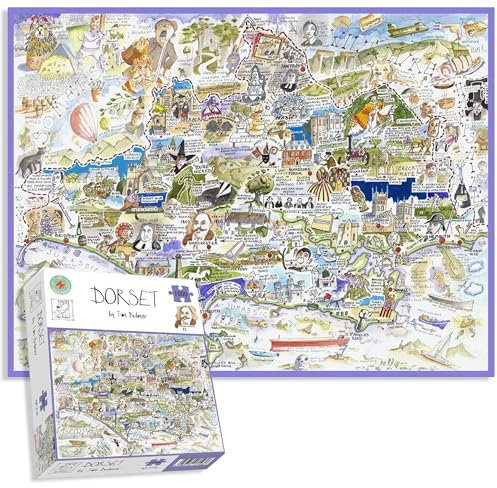
Comical Map Of Dorset, Artwork By Tim Bulmer - 1000 Piece Puzzle For Adults, Large Puzzle 66cm X 50cm In Size. Challenging To Complete But Fun And Humorous
The perfect gift for family and friends, they will love this quirky jigsaw puzzle. It's comical, light-hearted and great fun to complete
free shipping
Check price